Land surveying and mining engineering are two of the oldest disciplines in the world, dating back to prehistoric times. Both have been a vital part of human culture and civilization.

However, they are also highly technical and require advanced skills and knowledge to succeed. This is why land surveyors have been at the forefront of technological advances in both fields.

Uncovering the Role of Surveyors in Gold Coast Mapping Out the Future

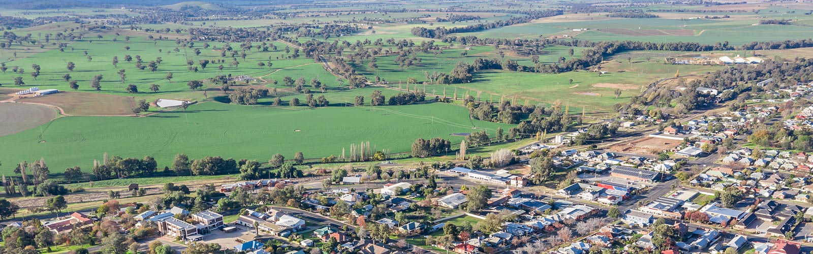
1. They’re the Future of Real Estate

Accurate land surveying is an essential part of urban development on Gold Coast, from subdividing a property to planning a major renovation. These surveys identify boundaries and limits, which protects the rights of property owners.

These surveys are also essential for identifying easements and rights of way, which are needed for building and maintaining infrastructure. They are used by government agencies to enforce construction and zoning regulations, and to evaluate existing infrastructure for possible revisions or additions.

Surveyors use a variety of methods to measure terrain, including GPS and electronic distance measurement (EDM) instruments. EDMs are more accurate than old-fashioned theodolites and can quickly and accurately measure large areas.

2. They’re the Future of Construction

When building a new structure, surveyors are often the first people called to get measurements of land to ensure the project fits into the landscape. These professionals also use GPS devices to collect land survey data and Geographic Information Systems (GIS) technology to create maps and reports.

Modern day surveyors work in a much different technological landscape than those of the past. Using multiple sensor types and intelligent automated workflows, surveyors can now capture reality quicker than ever.

As a result, it’s crucial that surveyors remain receptive to new technologies and embrace them as they become available. By ensuring they’re equipped with the right tools and are working in the right way, surveyors can help construction projects achieve their full potential.

3. They’re the Future of Infrastructure

The Gold Coast is experiencing unprecedented growth in population, infrastructure investment and tourism. This will transform it into a global city dedicated to business and employment growth for at least the next decade.

One of the key challenges facing the Gold Coast is tackling traffic congestion and squeezing more capacity from the existing roads. With a projected doubling of the region’s population by 2050, it’s important to create a more efficient transport network.

This is where the surveyor comes in. They’re able to use their expertise to ensure that the client has the information they need to make informed decisions throughout the project life cycle.

4. They’re the Future of Mining

Surveyors have played a pivotal role in mining and construction projects throughout Australia for many years. They work closely with developers, architects, engineers and town planners.

They also survey land, subdivide, resolve boundary disputes and conduct geotechnical investigations. They are the experts in their field and use the latest technology to achieve creative, accurate solutions.

Despite the growth of technology, the industry is still a relatively risky, inconvenient and hazardous place to work, especially for those in remote areas. IIoT and automation offer a solution to these problems, improving productivity, reducing costs and bringing the precision and bandwidth of technology into the heart of mining operations.

5. They’re the Future of Finance

Surveyors in Gold Coast are essential to the planning, design and construction of buildings and infrastructure projects. They use sophisticated instruments to accurately take measurements of the Earth’s surface and map the location of landmarks.

They also map out property lines for building and real estate projects to avoid boundary disputes. They use a range of equipment, including Global Positioning System (GPS) units, robotic total stations and GIS software.

Surveyors have a range of interests, from working with tools and machines to making and fixing things and investigating natural laws. They tend to be realistic, stable, persistent and genuine. They are also investigative, intellectual and inquisitive.

If you are thinking of buying a new property, it is important to hire professional surveyors. They can help you get a clear picture of your property and ensure that all the problems that could affect its value are fixed before you sign on the dotted line.

Surveying is the process of measuring and mapping the land using specialised technology, tools and equipment. This is done in order to make accurate measurements and computations for various purposes.

1. They can help you get a clear picture of the property

Whether you are buying a new property or planning to build a large addition on your existing one, it is important to have a clear picture of the property before you make any decisions. Professional surveyors will provide you with a detailed description of the land and its boundaries. They can also help you understand the existing deeds and identify any potential legal issues.

Depending on where you live, a survey may be required by a lender or title company before you close on a property. It is also a must-have if you intend to construct any building projects on your property, because it will ensure that the buildings are in compliance with local zoning regulations and setback requirements. It will also protect your legal rights and prevent any dispute later on. If you are looking to hire a surveyor for your Sydney property, it is essential that you find an experienced and reliable person.

2. They can help you get the best deal

One of the most important aspects of a property purchase is getting a good deal. Luckily, professional surveyors in Sydney can make the process much easier and faster than you might think. They can also help you avoid any legal problems that might otherwise befall you in the future, and they will provide you with accurate information about your new home. Whether you’re in the market for a new home, looking to sell your current one or are just curious about the value of your land, it’s always best to consult a professional surveyor before making any decisions.

3. They can help you avoid any legal problems

Whether you are buying a home, developing your land or installing a pool, professional surveyors are important to make sure that everything goes smoothly. They will provide you with a detailed report and plan that shows any existing structures, easements or encumbrances on the property. This is especially useful when you’re building a new home or adding on to an existing one.

They can also help you avoid any legal problems by making sure that you are not building something that is prohibited by the local laws. This can save you time and money on extra construction costs. They can even act as expert witnesses in court, and they take full responsibility for the accuracy of their surveys. It’s also worth double-checking the measurements of their equipment to ensure that they are accurate. This can be done by checking the property records with online tools like Courthouse Direct. It’s a small price to pay for peace of mind.

4. They can help you get the best soil

A lot of people don’t realize that a good soil test is an essential step in any construction project. This is especially true if you’re going to build a home or garden. The soil is an extremely important part of any project and it can determine the outcome and cost of your efforts.

Professional surveyors are the best choice when it comes to finding out exactly what is beneath your feet. They have the tools and expertise to do it properly and efficiently, saving you time and money down the line. If you’re planning to build a home, it’s worth hiring one of the leading Sydney land surveying companies for a free quote and to see what they can offer you. They can help you avoid costly legal problems and get an accurate estimate of the value of your property. With the right information, you can make informed decisions about your new home or garden.

Having local expertise is crucial to successful marketing as it requires the ability to understand the local market and adjust marketing practices accordingly. For example, in the quick service restaurant (QSR) industry, it is essential to understand how advertising dollars are allocated and spent within this sector so that local marketing sellers can provide their advertisers with a relevant marketing message.

Professionalism

Professionalism is the practice of carrying out activities in a manner that demonstrates respect for others and abides by rules of conduct. Developing and maintaining this behavior is vital to job success.

Professionals also demonstrate a high level of work ethic and excellence. Having strong professional ethics can lead to better workplace performance and increased career opportunities.

In the modern world, professionalism has come to mean much more than simply “neatness” or “dress code.” It’s an attitude and way of life.

It’s a trait that reflects how well you treat your co-workers and clients. It demonstrates that you take your job seriously and are committed to meeting deadlines and providing the best service possible.

Technology

Modern surveyors use a variety of technology to perform their jobs. From drones to GPS, surveyors are able to measure and report data with improved accuracy and speed.

One of the most common types of drones is the octocoptogram (octo-gram). These machines are equipped with high-tech sensors and software that allow them to detect the smallest objects, including micrometer-sized critters!

A new type of surveying is the deep tow, which is a high-tech aerial system that can map the ocean floor. This is used by the US Navy to locate missing aircraft, and can be a boon for commercial companies that wish to know where their stockpiles of aggregate are at any given time.

While it’s true that technology isn’t always an absolute winner, the right tools can make your job easier, and give you a competitive edge in the industry. The most impressive is that a lot of these tools are incredibly affordable, making them accessible to even the average Joe.

Safety

Land surveyors spend a lot of time on the road and in construction sites. As such, they need to be mindful of safety measures and take the necessary precautions to ensure their own safety as well as that of their colleagues.

Fortunately, a land surveyor in Wollongong is well-trained in the proper use of all the latest tools and equipment to ensure their own safety as well as that their colleagues’. They also adhere to a comprehensive and well-developed safety program that aims to keep the community safe at all times, while ensuring each and every project they undertake is executed in a timely and efficient manner.

It is no secret that Wollongong is home to some of Australia’s finest infrastructure, but it is also a city with some of the nation’s most dangerous streets, in part thanks to a recent spate of fatalities along the route to and from schools. To make travel safer for children and adults, the Safe Streets to School Wollongong campaign launched a petition urging council to implement separated paths and priority crossing points around all schools within a 2km radius of each campus.

Work-Life Balance

Wollongong surveyors have the advantage of working in a city with short commute times, allowing more time for family and personal life. This is a major benefit of working in a city and one that many employees find is key to achieving a healthy work-life balance.

Striking a work life balance that’s right for you is going to look different to everyone, but there are some general tips and strategies that can help. For example, taking a lunch break is essential for employees to get the energy they need to be productive.

Additionally, encouraging employees to take vacation days is also an important part of a healthy work life balance. Studies show that vacations help employees feel less stressed and more energized afterward.

Land surveying is a fascinating field that has its roots in historical technique. It’s a profession that is still needed today, and it can be done in many different ways.

The field of land surveying is constantly evolving and changing, but it is always necessary. Fortunately, modern technology is making it easier for land surveyors to do their job more efficiently.

Discover the Fascinating World of Land Surveying From Historical Technique

Magnetic Compass

The Magnetic Compass is a simple device that uses magnetic fields to determine the direction of a magnetized needle. This instrument can be used on land or in the ocean, and has been around for thousands of years.

It consists of a circular brass box that houses a magnetic needle. This needle swings over a 360-degree bass circle.

This instrument can be used to measure horizontal angles such as angles in buildings and related measurements. The compass has graduations to indicate degrees and half-degrees.

On a survey chart, you’ll see the headings indicated in degrees and also declination (a difference between true north and magnetic north). These are important because variation and deviation are noted on charts.

Theodolites

Theodolites are a type of precision instrument that can be used to measure horizontal and vertical angles. Surveyors use these instruments to make precise measurements of areas in order to create maps or build roads.

The instrument features a swiveling telescope that can be adjusted to measure both horizontal and vertical angles. It also has a sight that can be used to align the telescope and a crosshair that can be aimed at a specific point.

Modern theodolites are equipped with vernier scales that can measure angles to a small degree, such as 0.1’ or 1 second. In addition, some models can be adjusted to double angles for error reduction.

Theodolites are a crucial tool for land surveying, but they require careful care and maintenance to function correctly. They also need a variety of accessories to ensure their accuracy and efficiency. These include tripods, cases, batteries, targets, prisms, software and data collectors.

Telescopes

Whether surveying for construction, land development or mapping, it’s important to get big measurements right. That’s why surveyors use a range of equipment including the optical theodolite, total station, 3D scanners, level and rod.

The earliest practices of land surveying can date back to the ancient Egyptians who constructed the Great Pyramid at Giza. They established precise plots of land for taxation and paved the way for modern surveying techniques.

Today, surveyors continue to map and measure critical man-made features on our planet. From roads and bridges to pipelines, surveying is an integral part of building everything from a three-bedroom tract house to a super skyscraper.

Leather Coverings

One of the perks of being a land surveyor is access to a library of surveying literature from the early 19th century up to the present day. Aside from the usual suspects, this illuminating repository is also home to an array of other notables. Some of the more interesting finds include an octavelloum adorned folio and a collection of archival genii, including a triumphed sized libryte, albeit it’s the small variety. The best part is, you get to try it all for free.

Tools

Land surveyors use a wide variety of tools to complete their work. They have access to equipment such as total stations, robotic total stations, theodolites, GNSS receivers, retroreflectors, 3D scanners, LiDAR sensors, radios, inclinometers and handheld tablets.

The tools are used to create the data used to define and map land. This includes ALTA/ACSM surveys, boundary surveying, construction surveying, location, site planning and subdivision surveying.

The main function of surveying is to determine the existing relative horizontal and vertical positions of various forms, boundaries and objects in space. This is done in two ways: the first is to establish a baseline, which allows angular measurements of other points to be derived; the second is to create a reference network for the establishment of new points at an existing position.

Topographic maps show the shape of land, including mountains and valleys. They are commonly used in land development and construction, as well as by professionals in geology and other disciplines.

They are made by drawing contour lines to connect points of equal elevation. Contour lines that are close together indicate steep terrain, while contour lines that are spaced far apart show gentle slopes.

From Property Lines to Topographical Maps The Importance of Accurate Land

Accuracy

Accurate topographic maps are essential to the planning and use of land. They can help people locate property boundaries, encroachment and setbacks, legality issues and more.

To produce a topographic map, surveyors must first locate and identify control points by conducting field surveys. These include horizontal and vertical control points that are used to establish longitude, latitude and elevations for each map interval.

The process of generating topographic maps is a complex one that requires the skills and expertise of many different individuals, including surveyors, engravers, fact checkers, printers, and more. The accuracy of a map depends on many factors, including the type of survey, terrain and vegetation, and human error.

Encroachment

Encroachments are structures that are built or extended over someone else’s property line without their permission. They can be minor or major, and can impact the value of your home if you decide to sell it in the future.

One way to resolve encroachment problems is by speaking with your neighbor and coming to an agreement about how to handle the situation. However, in some cases, a court case may be necessary to get the offending party to remove their structure.

It’s important to understand that encroachments can happen either intentionally or unintentionally. Some are minor and don’t affect your property value significantly, while others can be a nuisance or a safety concern.

Setbacks

When it comes to land, a topographical map is one of the most important things you can have. Many people use these maps for hiking, camping, and driving.

Topographical maps show the elevation of mountains, the depths of oceans, and the steepness of slopes. They also provide information on water features, vegetation, roads and railroads, cities, mines, and survey control points.

One of the main features that sets a topographical map apart is the use of contour lines to illustrate the shape of the terrain. These imaginary lines connect points that have the same elevation on the Earth’s surface above or below a reference surface, which is usually mean sea level.

Legality

Before you purchase a new home or sell your current one, it is important to be sure that all the lines are straight. This will prevent boundary disputes and encroachments that could cause you serious headaches in the long run.

Typically, property boundaries are determined by physical markers, such as trees, boulders, and rivers. However, these are not always accurate.

Topographic maps are a good place to start when searching for the correct line of demarcation. They provide a precise depiction of the terrain, including elevation and relief.

They can also be used for other purposes, such as tracing the path of a river or finding a national park. They are especially useful for orienteering and hiking, as they can indicate which direction creeks flow, how deep a gully is, or how fast the terrain will change. Often, they can be used by government agencies for emergency management and disaster planning as well. They are often more difficult to produce than a simple map and require specialized equipment.