Introduction

Land surveying plays a pivotal role in Australia’s infrastructure development, ensuring that construction and development projects are built on a strong foundation of accurate data. However, surveying often comes with challenges, such as navigating underground utilities, working in environmentally sensitive areas, and handling diverse terrains. Precision is critical, as even minor errors can lead to costly consequences.

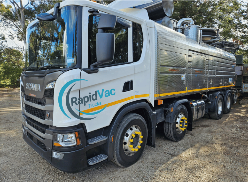
To address these challenges, Australian land surveyors increasingly rely on vacuum trucks. These vehicles, equipped with advanced suction and excavation technology, provide safe and accurate solutions for site preparation. This blog explores why vacuum trucks have become an indispensable tool for achieving precise results in land surveying.

The Role of Land Surveying in Infrastructure Development

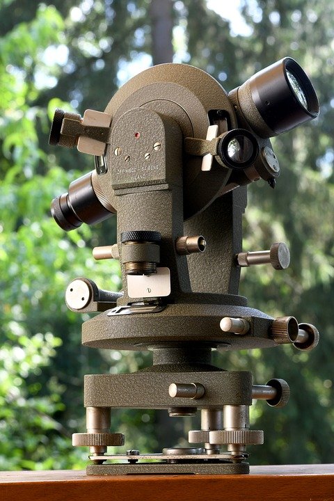
Land surveying is essential for mapping and understanding the physical features of a site before construction or development begins. It involves measuring and documenting land boundaries, terrain characteristics, and underground utilities to ensure projects are planned with accuracy.

In Australia, surveyors face unique challenges, including dense urban infrastructure in cities like Sydney and Melbourne, vast remote areas, and sensitive ecosystems. These factors demand tools and methods that prioritise precision, safety, and environmental care. Vacuum trucks meet these requirements by enabling surveyors to navigate these complexities effectively.

What Are Vacuum Trucks, and How Do They Work?

Vacuum trucks, also known as vacuum excavation trucks, are specialised vehicles designed for non-destructive excavation. They use a combination of pressurised air or water to break up soil and a high-powered vacuum system to remove it safely.

The process begins with the use of an air or water lance to loosen compacted soil. The loosened material is then suctioned into the truck’s debris tank, leaving the underlying utilities or structures untouched. This non-invasive approach is particularly valuable for Australian land surveyors who need to expose underground features without causing damage.

How Vacuum Trucks Enhance Land Surveying Accuracy

One of the primary reasons Australian surveyors rely on vacuum trucks is their ability to safely expose underground utilities. In urban areas, where networks of pipes, cables, and conduits are densely packed, traditional digging methods risk accidental strikes. Vacuum trucks eliminate this risk, ensuring utilities are clearly identified and preserved during the surveying process.

Additionally, vacuum trucks provide a clean and precise excavation site, making it easier for surveyors to gather accurate data. This level of precision is particularly crucial in infrastructure-heavy areas and projects requiring detailed mapping, such as roadworks and railway upgrades.

Benefits of Vacuum Trucks for Land Surveyors

Vacuum trucks offer numerous advantages, making them a preferred choice for land surveyors across Australia:

Safety

By using non-destructive excavation techniques, vacuum trucks minimise the risk of utility strikes, which can lead to service disruptions, financial penalties, and safety hazards for workers.

Efficiency

Suction excavation is faster than traditional methods, allowing surveyors to prepare sites more quickly. This reduces project timelines and ensures efficient use of resources.

Versatility

Vacuum trucks are capable of operating in various soil conditions and terrains, from sandy coastal areas to clay-heavy regions. This versatility makes them suitable for projects across Australia’s diverse landscapes.

Environmental Impact

The precision and control offered by vacuum trucks minimise disruption to the surrounding environment. This is particularly important in projects near protected habitats or culturally significant sites.

Applications of Vacuum Trucks in Australian Land Surveying

Vacuum trucks are highly versatile, making them an essential tool in various land surveying applications across Australia. Here are some of the most common use cases:

Urban Development Projects

In densely populated cities like Sydney and Melbourne, accurate land surveying is critical for planning new residential and commercial developments. Vacuum trucks allow surveyors to safely expose underground utilities and collect precise data without causing disruption to the surrounding infrastructure.

Infrastructure Upgrades and Maintenance

Australia’s growing cities require regular upgrades to roads, railways, and utilities. Vacuum trucks play a key role in these projects by enabling non-destructive excavation and accurate utility mapping, ensuring that essential services remain undisturbed during construction work.

Environmental and Conservation Surveying

Australia’s unique ecosystems, such as wetlands and bushlands, demand environmentally friendly surveying techniques. Vacuum trucks provide a non-invasive way to clear debris and expose underground structures, making them ideal for projects that prioritise environmental conservation.

Large-Scale Construction Projects

From industrial complexes to public infrastructure, large-scale projects rely on precise surveying to minimise risks and ensure project success. Vacuum trucks help surveyors clear areas and identify potential underground obstructions efficiently and accurately.

Comparison of Vacuum Trucks and Traditional Excavation Methods

While traditional excavation methods have been widely used in surveying and construction, they often fall short in terms of safety, efficiency, and environmental care. Here’s how vacuum trucks from Rapid Vac Trucks provide a superior alternative:

Speed and Accuracy

Traditional methods like manual digging or mechanical excavation are time-consuming and less precise. Vacuum trucks work quickly while ensuring high levels of accuracy, making them a more efficient choice for surveyors.

Cost Benefits

Accidental utility strikes during traditional excavation can lead to costly repairs and project delays. Vacuum trucks reduce these risks, saving money in the long run.

Environmental Impact

Traditional excavation can cause significant disruption to soil structure and surrounding vegetation. Vacuum trucks, on the other hand, offer a non-invasive solution that minimises environmental harm.

Challenges in Using Vacuum Trucks for Surveying Work

While vacuum trucks are invaluable for land surveying, their use can present some challenges. However, these are often outweighed by the benefits and can be mitigated with proper planning and resources:

Operating in Remote Areas

Australia’s vast landscapes mean that some surveying projects are located in remote areas, where access for vacuum trucks can be difficult. To overcome this, surveyors use portable suction systems or smaller, more manoeuvrable vehicles designed for such conditions.

Skilled Operators

Operating a vacuum truck requires specialised training to ensure safety and efficiency. Many Australian companies invest in operator training programmes to build the necessary skills and expertise.

Maintenance Requirements

Regular maintenance is essential to keep vacuum trucks operating effectively. Companies often implement strict servicing schedules to minimise downtime and extend the lifespan of their equipment.

The Growing Adoption of Vacuum Trucks in Australia

The use of vacuum trucks in land surveying and related fields has grown significantly across Australia. This trend is driven by increasing awareness of their benefits and the evolving needs of industries seeking safe, efficient, and environmentally friendly solutions.

Industry Trends Favouring Vacuum Trucks

As Australia’s cities continue to expand, the demand for non-destructive excavation methods has risen. Projects involving urban infrastructure, environmental conservation, and utility maintenance are increasingly reliant on vacuum trucks to meet their needs.

Impact of Safety and Environmental Regulations

Stricter workplace safety and environmental protection regulations have encouraged the adoption of vacuum trucks. Their ability to reduce risk and minimise environmental disruption aligns perfectly with these standards, making them a preferred choice for compliance-conscious companies.

Future Prospects

With advancements in technology and growing recognition of their value, vacuum trucks are expected to play an even more prominent role in land surveying and excavation work. From improved automation to increased energy efficiency, future innovations will further enhance their capabilities.

Conclusion

Vacuum trucks have become an essential tool for land surveyors across Australia, addressing many of the challenges associated with traditional excavation methods. Their ability to deliver precise results, ensure safety, and minimise environmental impact makes them invaluable in a wide range of applications, from urban development to conservation projects.

As industries continue to embrace this innovative technology, the role of vacuum trucks in shaping Australia’s infrastructure and landscapes will only grow. For surveyors seeking accurate and reliable solutions, investing in vacuum trucks is a smart and forward-thinking decision.

FAQs

1. What makes vacuum trucks essential for land surveying?

Vacuum trucks provide non-destructive excavation solutions that allow surveyors to safely expose underground utilities and clear sites with precision. This ensures accurate mapping and reduces risks associated with traditional methods.

2. How do vacuum trucks minimise environmental impact?

By using non-invasive techniques, vacuum trucks minimise soil disruption and avoid damage to surrounding vegetation. This makes them ideal for projects near sensitive ecosystems or in urban green spaces.

3. Are vacuum trucks suitable for remote surveying projects?

Yes, vacuum trucks can be adapted for remote areas using portable systems or smaller vehicles designed for challenging terrains. This versatility makes them effective even in Australia’s vast landscapes.

4. How do vacuum trucks contribute to project efficiency?

Vacuum trucks work faster than traditional excavation methods, enabling quicker site preparation and reducing project timelines. This helps contractors and surveyors meet deadlines while maintaining accuracy.

5. What industries in Australia benefit most from vacuum trucks?

Vacuum trucks are widely used in construction, utilities, environmental conservation, and emergency response projects. Their versatility makes them an essential tool in many industries requiring precise excavation work.

Whether you are building a new home or renovating an existing one, you should always get a survey of your property. This will help you know where your land is, as well as any encroachments or other issues that may arise.

There are many different types of surveys, but the accuracy of these measurements depends on several factors. Those include weather conditions, terrain and vegetation.

Boundary Surveys

When you are planning to build a new home, erect a fence or extend your property, it is important to determine where the exact boundary lines and corners are. Accurate surveying can prevent disputes between neighbours and ensure that your property line is accurately depicted in the land title plan.

This can be done by having a Boundary Identification Survey carried out which has a high degree of accuracy and establishes the true position of your boundaries in relation to neighbouring properties. These surveys require 2 site visits and a specific type of plan that is lodged into the Titles Office.

Only Registered Cadastral Surveyors can carry out this work so be sure to ask your land surveyor in Brisbane for their cadastral endorsement before having your boundaries marked. This will protect your interests and avoid costly legal disputes.

Topographic Surveys

If you’re building a new home or doing a major renovation on your Brisbane property, you may need a topographic survey before construction begins. This survey will help architects and engineers to plan the structure to fit well with the landscape.

A topographic survey creates a detailed map of the terrain, elevation and properties structures. This is done by using specialized instruments like GPS, EDM and total station theodolites to collect data.

The cost of a topographic survey depends on the size and complexity of the property. Larger parcels with varying elevations and terrain levels can take longer to survey than small plots.

Elevation Surveys

An elevation survey is a great way to determine the height of your property as well as what you can and cannot build. This is particularly useful if you are relocating your home to a new location as it may help you secure the necessary land permits before construction begins. The best part is that this information can be incorporated into your landscaping plans to give you the aesthetically pleasing outdoor space you’ve always wanted.

Construction Surveys

A construction survey is the process of staking out reference points and markers that will guide the construction of new structures like roads or buildings. These markers are typically staked out using the project’s chosen coordinate system.

During construction, it’s important to double-check the position of these markers so that you can make sure everything is built correctly and safely. This can save you money down the line, and ensure that your property is safe and functional for years to come.

Construction surveys can also help establish the location and alignment of bridges, highways, pipes, buildings, and other man-made objects. They are used after large-scale projects have been completed, as well.

Construction surveys are essential to engineering projects because they help ensure that a building or roadway will be safe and viable for its intended use. They also provide a detailed overview of the land, including its current conditions and any existing issues that may need to be addressed before the construction begins.

Whether you’re building a new house, renovating your current home or adding to an existing block, surveyors play an important role in Adelaide’s urban development.

Working closely with architects, engineers and geologists, surveyors are the first people to take measurements on any construction site. These primary measurements are then used by architects to make the most of the landscape and by engineers to plan structures safely.

Planning

Planning is a process that involves setting objectives and determining a course of action to achieve those objectives. It requires managers to be aware of environmental conditions and to forecast future conditions.

The planning process begins with environmental scanning which consists of gathering and interpreting information about the environment and then trying to predict future conditions. It also requires good decision making skills to choose the best possible solution to a problem.

Surveyors in Adelaide are responsible for establishing the land property boundaries (cadastral surveying) and positioning infrastructure. They also provide foundation spatial data, geographic place names, and cadastral map production.

Surveying

Surveying is a vital element in the planning and construction of most forms of infrastructure, transportation and communications, as well as the definition of legal boundaries for land ownership. It requires knowledge of geodesy, geometry, trigonometry, regression analysis, physics, engineering, and metrology.

As a result, the field is also an important tool for scientific research in many other disciplines. Its use can be enhanced by the application of new technologies, such as GNSS receivers, retroreflectors, 3D scanners, LiDAR sensors, radios, inclinometers, handheld tablets, optical and digital levels, subsurface locators, and GIS software.

Surveyors are experts in establishing control networks and monitoring the progress of construction and infrastructure projects. They can also provide accurate and reliable data that help build smart cities.

Mapping

Surveying is an important part of the planning process. It involves using a variety of instruments, including a compass and measuring device, to map land features and topography.

Surveyors can also use a theodolites to measure angles. This can help them to create accurate and detailed maps.

Mapping is an important component of urban development because it helps to reveal the distribution of health-promoting infrastructure and amenities. This information can help local and regional planners to identify inequities in access, encourage accountability and empower communities to advocate for improvements.

The project involved mapping and vegetation data collection for settled areas in the Resilient East and Adapting Northern Adelaide Regions. Seed Consulting Services worked in partnership with EnDev Geographic and AeroScientific to undertake urban heat mapping and vegetation data collection for these areas. They also conducted microscale climate measurements.

Reporting

A good reporting system is an important component of any successful urban development. This is because it allows the people involved in a project to get timely information on their progress and whether they are on track.

A report can also provide the basis for a decision about what needs to be done, or if something has been wrong. It can also alert people to serious conditions that could harm individuals, the university or cooperative partners.

A report from a surveyor can provide valuable information about land development trends and projected demand, as well as land supply. This information can then be used to ensure that the planning system is able to provide adequate land for future development, which will then support the overall economic growth and wellbeing of Adelaide.

If you are thinking about buying a property in Canberra, it is important to navigate the market. In this article we will look at the role of surveyors and how they can help you make the right decision.

Surveyors are professionals that perform surveys of land and buildings to determine the legal boundaries. They also prepare maps, plans and survey drawings to provide accurate information for construction projects.

Navigating the Canberra Property Market The Role of Surveyors

Boundary Surveys

Boundary surveys are a common way to determine the exact boundaries of a property. They can be helpful for constructing fences and home extensions, but they’re also important to know if you plan on dividing up a large piece of land into smaller lots or updating an old survey.

Surveyors in Canberra use a variety of techniques to locate the boundaries, dimensions and geographic features of your property. These include assessing public records, measuring natural and man-made landmarks, identifying the size of a property, determining visible utilities and examining topography.

A boundary survey can be ordered for a number of purposes, including plotting out a construction project or to secure a loan. It’s also useful for homeowners who want to establish easements or install new utilities.

Building Surveys

If you’re planning to buy a property, it’s wise to engage the services of a qualified surveyor. These professionals are able to identify issues with a building and provide advice about how they can be rectified.

In addition, they will advise you about the condition of the building and its maintenance. In many cases, a survey can save you thousands of pounds in repair costs.

The cost of a survey will depend on the size or value of the property, and different firms of surveyors will charge different fees. Nevertheless, the savings you make from having the survey performed will usually outweigh its costs.

Despite the slowdown, Canberra’s property market remains healthy. While prices have slowed in some areas, there’s still a demand for new builds, entry-priced homes and units.

Property Inspections

Home inspections are a way to assess the condition of the property you’re interested in buying. They can help you avoid a bad purchase deal or arrange for repairs before you close on the house.

They also help you determine whether a seller is willing to negotiate a lower price for the house. If they aren’t, you can request another inspection or cancel the sale altogether.

A home inspection is a process in which a certified surveyor inspects the exterior, interior and foundation of a house. It includes checking for issues with the roof, electrical and plumbing systems.

Home inspections are usually a requirement for both buyers and sellers of homes. They are also required for properties that have recently been foreclosed, according to Domain.

Valuation

Valuations are a key component of the property market, helping to determine the worth of your Canberra home. They are done by a certified property valuer, who will use a number of different methods to establish the market value.

They will use a direct comparison approach, which will look at the subject property and similar properties in the area. They will also use a summation approach to determine the property’s value.

Inflation and the RBA’s recent interest rate rises are taking a toll on Australia’s property market. According to CoreLogic, the median property price in Australia has dropped -4.2% since the RBA’s first rate hike in April 2022.

Real estate agents say Canberra’s housing prices are falling much less than Sydney and Melbourne, and that the market is more resilient than many other capital cities. However, they expect the next interest rate increase to further erode borrowing capacity and drive further falls in house prices.

Land surveying and mining engineering are two of the oldest disciplines in the world, dating back to prehistoric times. Both have been a vital part of human culture and civilization.

However, they are also highly technical and require advanced skills and knowledge to succeed. This is why land surveyors have been at the forefront of technological advances in both fields.

Uncovering the Role of Surveyors in Gold Coast Mapping Out the Future

1. They’re the Future of Real Estate

Accurate land surveying is an essential part of urban development on Gold Coast, from subdividing a property to planning a major renovation. These surveys identify boundaries and limits, which protects the rights of property owners.

These surveys are also essential for identifying easements and rights of way, which are needed for building and maintaining infrastructure. They are used by government agencies to enforce construction and zoning regulations, and to evaluate existing infrastructure for possible revisions or additions.

Surveyors use a variety of methods to measure terrain, including GPS and electronic distance measurement (EDM) instruments. EDMs are more accurate than old-fashioned theodolites and can quickly and accurately measure large areas.

2. They’re the Future of Construction

When building a new structure, surveyors are often the first people called to get measurements of land to ensure the project fits into the landscape. These professionals also use GPS devices to collect land survey data and Geographic Information Systems (GIS) technology to create maps and reports.

Modern day surveyors work in a much different technological landscape than those of the past. Using multiple sensor types and intelligent automated workflows, surveyors can now capture reality quicker than ever.

As a result, it’s crucial that surveyors remain receptive to new technologies and embrace them as they become available. By ensuring they’re equipped with the right tools and are working in the right way, surveyors can help construction projects achieve their full potential.

3. They’re the Future of Infrastructure

The Gold Coast is experiencing unprecedented growth in population, infrastructure investment and tourism. This will transform it into a global city dedicated to business and employment growth for at least the next decade.

One of the key challenges facing the Gold Coast is tackling traffic congestion and squeezing more capacity from the existing roads. With a projected doubling of the region’s population by 2050, it’s important to create a more efficient transport network.

This is where the surveyor comes in. They’re able to use their expertise to ensure that the client has the information they need to make informed decisions throughout the project life cycle.

4. They’re the Future of Mining

Surveyors have played a pivotal role in mining and construction projects throughout Australia for many years. They work closely with developers, architects, engineers and town planners.

They also survey land, subdivide, resolve boundary disputes and conduct geotechnical investigations. They are the experts in their field and use the latest technology to achieve creative, accurate solutions.

Despite the growth of technology, the industry is still a relatively risky, inconvenient and hazardous place to work, especially for those in remote areas. IIoT and automation offer a solution to these problems, improving productivity, reducing costs and bringing the precision and bandwidth of technology into the heart of mining operations.

5. They’re the Future of Finance

Surveyors in Gold Coast are essential to the planning, design and construction of buildings and infrastructure projects. They use sophisticated instruments to accurately take measurements of the Earth’s surface and map the location of landmarks.

They also map out property lines for building and real estate projects to avoid boundary disputes. They use a range of equipment, including Global Positioning System (GPS) units, robotic total stations and GIS software.

Surveyors have a range of interests, from working with tools and machines to making and fixing things and investigating natural laws. They tend to be realistic, stable, persistent and genuine. They are also investigative, intellectual and inquisitive.

If you are thinking of buying a new property, it is important to hire professional surveyors. They can help you get a clear picture of your property and ensure that all the problems that could affect its value are fixed before you sign on the dotted line.

Surveying is the process of measuring and mapping the land using specialised technology, tools and equipment. This is done in order to make accurate measurements and computations for various purposes.

1. They can help you get a clear picture of the property

Whether you are buying a new property or planning to build a large addition on your existing one, it is important to have a clear picture of the property before you make any decisions. Professional surveyors will provide you with a detailed description of the land and its boundaries. They can also help you understand the existing deeds and identify any potential legal issues.

Depending on where you live, a survey may be required by a lender or title company before you close on a property. It is also a must-have if you intend to construct any building projects on your property, because it will ensure that the buildings are in compliance with local zoning regulations and setback requirements. It will also protect your legal rights and prevent any dispute later on. If you are looking to hire a surveyor for your Sydney property, it is essential that you find an experienced and reliable person.

2. They can help you get the best deal

One of the most important aspects of a property purchase is getting a good deal. Luckily, professional surveyors in Sydney can make the process much easier and faster than you might think. They can also help you avoid any legal problems that might otherwise befall you in the future, and they will provide you with accurate information about your new home. Whether you’re in the market for a new home, looking to sell your current one or are just curious about the value of your land, it’s always best to consult a professional surveyor before making any decisions.

3. They can help you avoid any legal problems

Whether you are buying a home, developing your land or installing a pool, professional surveyors are important to make sure that everything goes smoothly. They will provide you with a detailed report and plan that shows any existing structures, easements or encumbrances on the property. This is especially useful when you’re building a new home or adding on to an existing one.

They can also help you avoid any legal problems by making sure that you are not building something that is prohibited by the local laws. This can save you time and money on extra construction costs. They can even act as expert witnesses in court, and they take full responsibility for the accuracy of their surveys. It’s also worth double-checking the measurements of their equipment to ensure that they are accurate. This can be done by checking the property records with online tools like Courthouse Direct. It’s a small price to pay for peace of mind.

4. They can help you get the best soil

A lot of people don’t realize that a good soil test is an essential step in any construction project. This is especially true if you’re going to build a home or garden. The soil is an extremely important part of any project and it can determine the outcome and cost of your efforts.

Professional surveyors are the best choice when it comes to finding out exactly what is beneath your feet. They have the tools and expertise to do it properly and efficiently, saving you time and money down the line. If you’re planning to build a home, it’s worth hiring one of the leading Sydney land surveying companies for a free quote and to see what they can offer you. They can help you avoid costly legal problems and get an accurate estimate of the value of your property. With the right information, you can make informed decisions about your new home or garden.

Having local expertise is crucial to successful marketing as it requires the ability to understand the local market and adjust marketing practices accordingly. For example, in the quick service restaurant (QSR) industry, it is essential to understand how advertising dollars are allocated and spent within this sector so that local marketing sellers can provide their advertisers with a relevant marketing message.

Professionalism

Professionalism is the practice of carrying out activities in a manner that demonstrates respect for others and abides by rules of conduct. Developing and maintaining this behavior is vital to job success.

Professionals also demonstrate a high level of work ethic and excellence. Having strong professional ethics can lead to better workplace performance and increased career opportunities.

In the modern world, professionalism has come to mean much more than simply “neatness” or “dress code.” It’s an attitude and way of life.

It’s a trait that reflects how well you treat your co-workers and clients. It demonstrates that you take your job seriously and are committed to meeting deadlines and providing the best service possible.

Technology

Modern surveyors use a variety of technology to perform their jobs. From drones to GPS, surveyors are able to measure and report data with improved accuracy and speed.

One of the most common types of drones is the octocoptogram (octo-gram). These machines are equipped with high-tech sensors and software that allow them to detect the smallest objects, including micrometer-sized critters!

A new type of surveying is the deep tow, which is a high-tech aerial system that can map the ocean floor. This is used by the US Navy to locate missing aircraft, and can be a boon for commercial companies that wish to know where their stockpiles of aggregate are at any given time.

While it’s true that technology isn’t always an absolute winner, the right tools can make your job easier, and give you a competitive edge in the industry. The most impressive is that a lot of these tools are incredibly affordable, making them accessible to even the average Joe.

Safety

Land surveyors spend a lot of time on the road and in construction sites. As such, they need to be mindful of safety measures and take the necessary precautions to ensure their own safety as well as that of their colleagues.

Fortunately, a land surveyor in Wollongong is well-trained in the proper use of all the latest tools and equipment to ensure their own safety as well as that their colleagues’. They also adhere to a comprehensive and well-developed safety program that aims to keep the community safe at all times, while ensuring each and every project they undertake is executed in a timely and efficient manner.

It is no secret that Wollongong is home to some of Australia’s finest infrastructure, but it is also a city with some of the nation’s most dangerous streets, in part thanks to a recent spate of fatalities along the route to and from schools. To make travel safer for children and adults, the Safe Streets to School Wollongong campaign launched a petition urging council to implement separated paths and priority crossing points around all schools within a 2km radius of each campus.

Work-Life Balance

Wollongong surveyors have the advantage of working in a city with short commute times, allowing more time for family and personal life. This is a major benefit of working in a city and one that many employees find is key to achieving a healthy work-life balance.

Striking a work life balance that’s right for you is going to look different to everyone, but there are some general tips and strategies that can help. For example, taking a lunch break is essential for employees to get the energy they need to be productive.

Additionally, encouraging employees to take vacation days is also an important part of a healthy work life balance. Studies show that vacations help employees feel less stressed and more energized afterward.

Navigating Land Legal Descriptions in Real Estate Transactions

[ad_1]

Navigating Land Legal Descriptions in Real Estate Transactions

Real estate transactions involve a number of complex legal matters, many of which require an understanding of the legal description of the property in question. A legal description is a technical description of the boundaries of a parcel of land and the rights associated with it. It is an important document that must be understood and properly interpreted in order to ensure a successful real estate transaction.

What is a Legal Description?

A legal description is a precise and detailed description of a parcel of land, including its boundaries, dimensions, and any encumbrances or rights associated with it. It is typically used in real estate transactions to identify and describe a property. The legal description is used to accurately define the ownership rights of the parcel and to ensure that the buyer and seller are properly identified.

Types of Legal Descriptions

Legal descriptions can vary depending on the type of property being described. For instance, a legal description for a residential lot may include an address, lot size, dimensions, and any restrictions or easements associated with the property. A legal description for a commercial property might include a more detailed description of the property, such as its use, zoning restrictions, and other rights and encumbrances associated with the parcel.

How to Read a Legal Description

Reading a legal description can be a daunting task for a novice real estate investor. It is important to take the time to understand the document and to carefully read through the text. The key elements of a legal description typically include the description of the boundaries of the parcel, as well as any restrictions, easements, or rights associated with the property. It is also important to understand the implications of any encumbrances or rights associated with the property, such as rights of way, access, and use restrictions.

Common Terms in Legal Descriptions

When reading a legal description, it is important to be familiar with some of the common terms used in such documents. For instance, many legal descriptions will include the term “metes and bounds”, which refers to the precise measurement of the boundaries of the parcel. Other common terms include “adjoining”, which refers to the relationship between two parcels of land, and “appurtenances”, which refers to any rights or privileges associated with the property.

Conclusion

Navigating legal descriptions in real estate transactions can be a complex process. It is important to take the time to understand the document and to familiarize oneself with the common terms used in such documents. It is also important to understand the implications of any rights or encumbrances associated with the property, as these could have an impact on the success of the transaction. By understanding the legal description and the rights associated with the property, real estate investors can ensure that their transactions are successful and that they are properly protected.
[ad_2]

How Elevation Data Can Help with Land Use Planning

[ad_1]

How Elevation Data Can Help with Land Use Planning

Elevation data is a valuable asset for land use planning. It can be used to identify areas that are prone to flooding, select sites for building construction, and optimize land development. In this article, we’ll explore how elevation data can help with land use planning and the various ways it can be used.

What is Elevation Data?

Elevation data is a set of spatial information that describes the height or elevation of a given area. This data is typically collected from sources such as satellite imagery, LiDAR, and aerial surveys. Elevation data can be represented as a digital elevation model (DEM), which is a three-dimensional representation of the Earth’s surface.

How Can Elevation Data be Used for Land Use Planning?

Elevation data can be used for mapping and planning purposes to identify potential sites for building construction and land development. It can also be used to identify areas that may be prone to flooding or other natural disasters.

In addition, elevation data can be used to assess the environmental impact of land use activities. For example, it can be used to identify areas that are likely to be affected by changes in topography. This can help inform decisions about which areas are safe to develop and which should be avoided.

What Are the Benefits of Using Elevation Data for Land Use Planning?

Using elevation data for land use planning can provide numerous benefits. It can help inform decisions about which areas are suitable for building construction or land development. It can also help identify areas that are prone to flooding or other natural disasters, which can help inform decisions about where to locate buildings or other infrastructure.

In addition, elevation data can be used to assess the environmental impact of land use activities. This can help inform decisions about which areas are safe to develop and which should be avoided.

Conclusion

Elevation data is a valuable asset for land use planning. It can be used to identify areas that are prone to flooding, select sites for building construction, and optimize land development. By using elevation data, planners can make informed decisions about which areas are safe to develop and which should be avoided.
[ad_2]

Best Practices for Establishing Control Points in the Workplace

[ad_1]

Best Practices for Establishing Control Points in the Workplace

The workplace is a complex environment. There are many variables and factors to consider when trying to ensure that everything runs smoothly. One of the most important aspects of workplace management is the establishment of control points. Control points are points within a workplace where responsibilities are assigned, rules and policies are enforced, and progress is monitored. Establishing control points is a vital step in keeping a workplace organized and efficient.

What are Control Points?

Control points are points within a workplace where responsibility is assigned, rules and regulations are enforced, and progress is monitored. Control points are important for many reasons, including:

• Ensuring that everyone is following the same rules and regulations
• Providing a clear hierarchy of authority
• Establishing accountability for tasks and activities
• Monitoring progress and performance
• Ensuring that goals and objectives are achieved

How to Establish Control Points in the Workplace

Establishing control points in the workplace is an important step in keeping the workplace organized and efficient. Here are some best practices for establishing control points:

• Identify Areas of Responsibility: The first step in establishing control points is to identify areas of responsibility within the workplace. This will ensure that everyone is aware of their roles and responsibilities and that tasks are assigned and monitored appropriately.

• Establish Rules and Regulations: Once areas of responsibility have been identified, it is important to establish rules and regulations for the workplace. These should include safety guidelines, policies regarding performance, and expectations for employee conduct.

• Monitor Progress: It is important to monitor the progress of tasks and activities in the workplace. This will help ensure that goals and objectives are being met and that everyone is on the same page.

• Hold Regular Meetings: Regular meetings should be held to review progress and discuss any changes or updates. This will help ensure that everyone is on the same page and that tasks are being completed efficiently.

• Reward Performance: Finally, it is important to reward performance in the workplace. This will help to encourage employees to work hard and remain motivated.

Conclusion

Establishing control points in the workplace is an important step in keeping the workplace organized and efficient. By following the best practices outlined above, you can ensure that everyone is aware of their roles and responsibilities and that tasks and activities are being completed efficiently. This will help to create a productive and successful workplace.
[ad_2]

Exploring the Benefits of Geodetic Devices in Surveying and Mapping

[ad_1]

Exploring the Benefits of Geodetic Devices in Surveying and Mapping

Geodetic devices are instruments used in surveying and mapping. These devices provide accurate measurements of the Earth’s surface features. They are used for a variety of applications, including measuring distances, angles, and elevation changes. Geodetic devices are important tools for any surveying and mapping project, as they provide the most accurate data available.

What are Geodetic Devices?

Geodetic devices are instruments used to measure the shape and size of the Earth’s surface features. They are typically used in surveying projects, such as determining the elevation of a given area or measuring the distance between two points. The most common type of geodetic device is the theodolite, which is used to measure angles and distances. Other geodetic devices include GPS receivers, total stations, and laser scanners.

How do Geodetic Devices Work?

Geodetic devices use a variety of techniques to measure the Earth’s surface features. The most commonly used technique is triangulation, which involves taking measurements from three points and using trigonometry to calculate the distance between them. GPS receivers use a satellite-based system to determine location and elevation. Total stations measure angles and distances using an optical prism. Laser scanners use pulses of light to create a three-dimensional map of the area being surveyed.

Benefits of Geodetic Devices

The accuracy of geodetic devices is their key benefit. These devices provide highly accurate measurements, which can be used to create precise maps and surveys. This accuracy is essential for any surveying or mapping project, as it ensures that the data gathered is reliable and can be used to make accurate decisions.

Geodetic devices are also easier to use than other surveying methods. They require minimal setup time, and once set up, they can quickly and accurately measure distances, angles, and elevation changes. This convenience makes them ideal for large-scale surveying projects, such as mapping a large area or measuring the elevation of a mountain range.

Finally, geodetic devices are cost-effective. They require minimal maintenance and are relatively inexpensive to purchase. This makes them a great option for any surveying and mapping project, as they provide accurate data at a low cost.

Conclusion

Geodetic devices are an essential tool for any surveying and mapping project. They provide accurate measurements of the Earth’s surface features, and they are easy to use and cost-effective. Geodetic devices can be used to measure distances, angles, and elevation changes, making them ideal for any surveying or mapping project.
[ad_2]

The Role of Technology in Topographic Surveys

[ad_1]

The Role of Technology in Topographic Surveys

Topographic surveying is a process used to measure, map, and document the features of a landscape. It involves the use of a variety of technologies, such as GPS, aerial imagery, and laser scanning. The primary goal of topographic surveying is to create a comprehensive map of the area that is both accurate and detailed.

GPS Technology

GPS (Global Positioning System) technology is one of the most common technologies used in topographic surveying. This technology utilizes a network of satellites that collect and transmit data to a receiver on the ground. The receiver uses this data to accurately determine the location of the surveyor and any points of interest in the area. GPS technology is incredibly accurate and can be used to quickly and easily survey large areas.

Aerial Imagery

Aerial imagery is another common technology used in topographic surveying. This technology utilizes drones, helicopters, or airplanes to take photographs or videos of the landscape from the air. These images can be used to create detailed maps of the area and can be used to determine the location of various features such as roads, rivers, and buildings.

Laser Scanning

Laser scanning is a relatively new technology that has become increasingly popular in topographic surveying. It utilizes lasers to accurately measure distances and angles between points of interest in the landscape. The data collected can be used to create highly detailed 3D maps of the area that can be used to accurately measure and document the features of the landscape.

Conclusion

Technology plays an important role in topographic surveying. The use of GPS, aerial imagery, and laser scanning technologies allow surveyors to quickly and accurately measure and document the features of a landscape. This data can then be used to create highly detailed maps of the area that can be used for a variety of purposes. As technology continues to evolve, topographic surveys will become even more accurate and efficient.
[ad_2]

3) How to Successfully Complete a Subdivision Survey

[ad_1]

How to Successfully Complete a Subdivision Survey

A subdivision survey is a necessary component of the subdivision process. It involves surveying and mapping land in order to divide it into smaller pieces. Subdivision surveys are an important part of any development project and must be completed correctly in order to ensure that all of the legal requirements are met.

Step 1: Understand Your Responsibilities

Before beginning the survey, it is important to understand the scope of your responsibilities. This includes understanding the area that needs to be surveyed, the legal regulations that must be complied with, and the timeline for completing the survey. You should also familiarize yourself with the different types of surveys that can be used, such as boundary surveys, topographical surveys, and ALTA surveys.

Step 2: Obtain the Necessary Documentation

It is important to obtain the necessary documents before beginning the survey. These documents include information such as deed restrictions, zoning requirements, and any other pertinent information. It is also important to obtain copies of any existing surveys that may be available.

Step 3: Establish Boundaries and Markers

The next step is to establish the boundaries of the surveyed area and to place markers at each corner. This will help to ensure that all of the boundaries are properly set and that the survey is accurately conducted.

Step 4: Gather Data

Once the boundaries have been established, it is time to begin gathering data. This includes taking measurements, collecting elevation data, and locating features such as roads, buildings, and other structures. It is important to be thorough when gathering data, as even a small discrepancy can lead to an inaccurate survey.

Step 5: Analyze the Data

The data that has been collected must then be analyzed in order to ensure that all of the legal requirements are met. This includes making sure that the boundaries are set correctly, that the measurements are accurate, and that any other necessary information is included.

Step 6: Prepare the Report

Once the data has been analyzed, it is time to prepare the report. The report should include all of the pertinent information regarding the survey, such as the boundaries, measurements, and other features. It should also include any recommendations or conclusions that were reached during the analysis.

Step 7: Submit the Report

Once the report has been prepared, it is time to submit it to the appropriate authorities. Depending on the jurisdiction, this may include submitting the report to the local government, the state government, or even the federal government.

Conclusion

A subdivision survey is an important part of the subdivision process. It is a detailed and complex process that requires thorough understanding of the regulations and accurate data collection. Following the above steps can help to ensure that the survey is completed correctly and that all of the legal requirements are met.
[ad_2]

The Benefits of Having a Professional Boundary Survey Performed

[ad_1]

The Benefits of Having a Professional Boundary Survey Performed

A boundary survey is an important step in the process of buying or selling a home. It is a tool used to assess the legal boundaries of a property, providing information about the exact legal limits of the land and the exact locations of any physical features of the land, such as buildings, trees, fences, and other structures.

Having a professional boundary survey performed is an important part of properly managing and maintaining a property. It can help protect property owners from potential boundary disputes, as well as provide valuable insight into the value of a property. Here are some of the benefits of having a professional boundary survey performed:

Ensures Accurate Property Lines

The primary benefit of having a professional boundary survey performed is that it ensures accurate property lines. This is critical in preventing boundary disputes between neighbors. It also helps to protect the property owner from any potential legal action that may be taken due to inaccurate property lines.

Professional boundary surveys are conducted using specialized equipment, such as GPS and laser-measuring devices, to ensure accuracy. This helps to ensure that the property lines are accurately marked, which is essential for proper land management and ownership.

Provides Insight into Property Value

Another benefit of having a professional boundary survey performed is that it provides insight into the value of a property. Professional surveyors are able to assess the land and provide accurate information regarding the size of the property, its location, and any features of the land. This can help to provide valuable insight into the value of a property, which can be useful when it comes to making decisions about buying or selling a property.

Helps Resolve Disputes

Having a professional boundary survey performed can also help to resolve disputes between neighbors. Professional surveyors are able to provide accurate information regarding the exact boundaries of a property, which can be used to resolve any disputes between neighbors. This can help to avoid costly legal battles, and can help to ensure that the boundaries of a property are accurately marked.

Ensures Compliance with Local Regulations

Professional boundary surveys also help to ensure that a property is compliant with local regulations. This is important for ensuring that a property is properly zoned and that it meets all of the necessary regulations. This can help to ensure that a property is properly managed and that it does not violate any local zoning laws.

Conclusion

Having a professional boundary survey performed is an important step in the process of buying or selling a home. It is a tool used to assess the legal boundaries of a property, providing information about the exact legal limits of the land and the exact locations of any physical features of the land, such as buildings, trees, fences, and other structures. It can help to ensure accurate property lines, provide insight into the value of a property, help to resolve disputes between neighbors, and ensure compliance with local regulations. All of these benefits make it essential that any property owner consider having a professional boundary survey performed.
[ad_2]

Shaping the Future of Cities with Urban Planning

[ad_1]

Shaping the Future of Cities with Urban Planning

Urban planning is the process of designing and creating cities and towns. It involves looking at the current and future needs of a city, such as housing, transportation, and economic development, and creating a plan for how to best meet those needs. Urban planning is about creating a better quality of life for all citizens by developing a safe, liveable, and sustainable city.

Urban planning has a long history, dating back to ancient times when cities were first built. The Ancient Romans were among the first to formally plan their cities, creating detailed designs for their streets, aqueducts, and public spaces. Today, urban planning has become even more important as cities continue to grow and evolve.

The Benefits of Urban Planning

Urban planning can have many benefits for a city. It can help create more efficient transportation networks, provide better access to public amenities such as parks and libraries, and make sure that all citizens have access to basic necessities such as housing and healthcare.

Urban planning can also help to reduce air and water pollution, create more green spaces, and improve public health. In addition, it can promote economic growth by creating better job opportunities, stimulating local businesses, and attracting new businesses and investments to the city.

Challenges of Urban Planning

Urban planning can be a complex process, and there are many challenges that must be faced. One of the biggest challenges is the rapidly changing nature of cities. Cities are constantly evolving, which can make it difficult to create a plan that is both effective and long-lasting.

In addition, urban planning can be expensive. Developing a city takes time, money, and resources, and it can be difficult to secure the necessary funding to make the plans a reality. Finally, there can be political obstacles to urban planning, as different stakeholders may have different opinions on how a city should be developed.

The Future of Urban Planning

Urban planning is an essential part of creating a better future for cities. As cities continue to grow and evolve, urban planning will become even more important. In the future, cities will need to be designed with sustainability in mind, with an emphasis on renewable energy, green spaces, and efficient transportation networks.

In addition, cities will need to create more affordable housing and better access to essential services such as healthcare and education. Finally, cities will need to create better job opportunities to attract new businesses and investments.

Conclusion

Urban planning is essential for creating a better future for cities. It can help to create more efficient transportation networks, provide better access to public amenities, and reduce air and water pollution. It can also help to promote economic growth and create better job opportunities.

In the future, cities will need to be designed with sustainability in mind and create better access to essential services, affordable housing, and job opportunities. Urban planning is an essential part of creating a better future for cities, and it will continue to play an important role in shaping the future of cities.
[ad_2]

Subdividing Land: A Guide to the Process and Regulations

[ad_1]

Subdividing Land: A Guide to the Process and Regulations

Subdividing land is a process that involves splitting up a larger piece of land into smaller, separate parcels or lots. This process can be done for several reasons, such as to develop multiple residential properties or to increase the value of the land. Before beginning the process of subdividing land, it is important to understand the regulations and procedures involved.

Understand the Regulations

The process of subdividing land is regulated by local governments, which have the authority to determine the zoning and subdivision regulations for the area. It is important to familiarize yourself with these regulations, as they will dictate the type of development that is allowed on the land, as well as the size and shape of the parcels that can be created. In addition to zoning and subdivision regulations, there may also be other regulations such as environmental regulations or restrictions from local historic societies that must be taken into account.

Gather Necessary Documents

In order to begin the process of subdividing land, several documents will need to be obtained. These documents include a deed or title, surveys of the land, and any applicable permits or licenses. A surveyor should also be hired to conduct a boundary survey of the land, which will help to ensure that the parcels created are in compliance with local regulations.

Submit an Application

Once all necessary documents have been obtained, an application must be submitted to the local government or planning department. This application should include a detailed description of the proposed subdivision, including the number of parcels to be created and the size of each parcel. Depending on the size and scope of the proposed subdivision, additional documents such as a site plan and environmental impact report may also be required.

Complete the Process

Once the application has been approved, the process of subdividing land can begin. Depending on the size and complexity of the project, this process can take several months or even longer. During this time, the surveyor will be responsible for creating and recording the new parcel boundaries, while also ensuring that they comply with local regulations. Once the process is complete, the parcels will be ready to be sold or developed.

Conclusion

Subdividing land can be a complex process, and it is important to understand the regulations and procedures involved before beginning. By familiarizing yourself with local zoning and subdivision regulations, gathering the necessary documents, and submitting an application, you will be well on your way to completing the process of subdividing land. With the right preparation, you can ensure that the process runs smoothly and that the parcels created are in compliance with all applicable regulations.
[ad_2]