Understanding the Basics of Land Legal Descriptions

[ad_1]

Understanding the Basics of Land Legal Descriptions

When it comes to understanding land legal descriptions, it can often be confusing and overwhelming. Knowing some of the basics can help to demystify the process and make it easier to understand. Legal descriptions are important for determining the boundaries of a property and help to ensure that all parties involved in the transaction are aware of the exact boundaries of the property.

What is a Legal Description?

A legal description is a written description of property boundaries that is recognized by the law. This description is typically used for land transactions, such as buying or selling property, and is also used to determine the exact boundaries of a property in case of legal disputes. Legal descriptions are usually based on the Public Land Survey System (PLSS) or other local surveying methods.

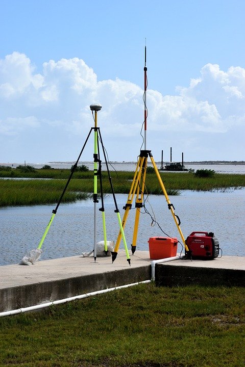
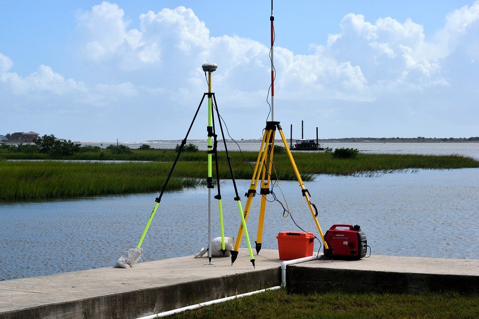
What is the Public Land Survey System?

The Public Land Survey System is a system of surveying and mapping land parcels in the United States. The system is divided into six-mile-square grids called townships. Each township is further divided into 36 one-mile-square sections, with each section consisting of 640 acres. The sections are further divided into quarter sections and then into quarter-quarter sections. This system allows for precise legal descriptions of land parcels.

Types of Legal Descriptions

There are two main types of legal descriptions: metes and bounds and plat.

Metes and Bounds

Metes and bounds is the oldest form of legal description and involves describing property using physical landmarks, such as rivers, creeks, mountains, and roads. The description will start at a point of beginning and will then describe the boundaries and angles of the property using directional markers and distances.
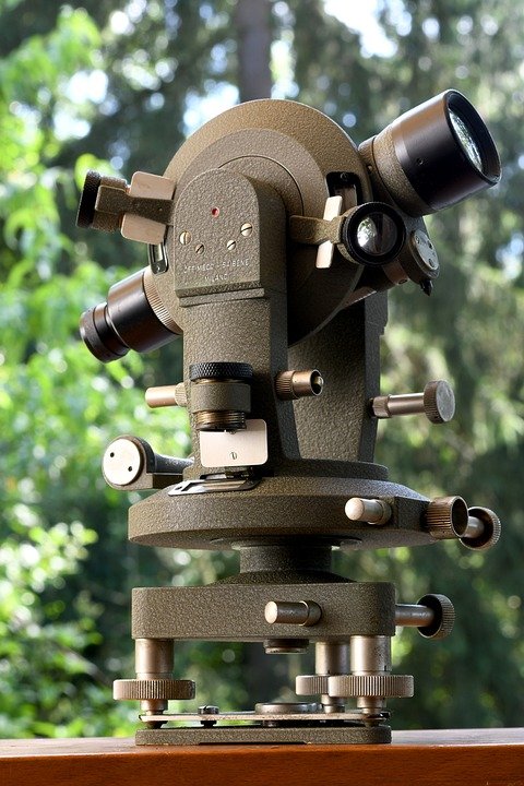
Plat

A plat is a map of a property that shows the exact boundaries of the land. Plats are created by professional surveyors and are typically used in more urban areas. Plats are divided into lots and will include a scale, a north arrow, and a legend.

Using Legal Descriptions

Understanding legal descriptions is important for anyone involved in buying or selling land. A good legal description should be precise and clear, and should be able to be used to accurately determine the exact boundaries of a property. Knowing the basics of legal descriptions can help to ensure that any land transaction goes smoothly and that all parties involved have a clear understanding of the boundaries of the property in question.
[ad_2]

Exploring the Benefits of Using Elevation Data for Navigation

[ad_1]

Exploring the Benefits of Using Elevation Data for Navigation

Navigation has become an integral part of modern daily life. Whether you’re using a GPS to get to an unfamiliar destination or making a trek through a dense forest, having access to reliable navigation data is essential. One of the most useful types of navigation data available is elevation data. Elevation data provides detailed information about the terrain, allowing you to customize your route and plan accordingly. Here, we’ll explore the benefits of using elevation data for navigation.

Detailed Terrain Information

Elevation data provides a detailed view of the terrain, giving you a better understanding of the route you’re taking. You can see the exact elevation profile of your route, which can be used to plan your route in advance. This data is especially useful when navigating difficult terrain, such as mountains, deserts, and forests.

Accurate Route Planning

Elevation data can be used to plan an accurate and efficient route. By taking into account the elevation changes along the route, you can determine the best way to travel. This allows you to plan ahead and avoid any potential obstacles or hazards that may be encountered along the way.

Real-Time Updates

One of the most useful features of elevation data is its ability to provide real-time updates. As you travel, the elevation data will be constantly updated, giving you the most up-to-date information about the terrain. This allows you to make adjustments to your route if necessary, ensuring that you stay on track.

Improved Safety

Using elevation data for navigation can help improve safety by providing detailed information about the terrain. By being aware of the terrain changes in advance, you can plan your route accordingly and avoid any potential hazards. This can be especially useful in areas where there may be hidden dangers, such as in dense forests or remote areas.

Improved Navigation Accuracy

Using elevation data for navigation can also improve the accuracy of your navigation. By taking into account the terrain changes, you can ensure that you’re taking the most efficient route. This can save time and energy, allowing you to reach your destination with minimal effort.

Conclusion

Using elevation data for navigation can provide numerous benefits, from improved safety to more accurate route planning. By taking into account the terrain changes and planning accordingly, you can ensure that you stay on track and reach your destination with minimal effort. With the help of elevation data, navigation can be made easier, faster, and more reliable.
[ad_2]

The Benefits of Developing Control Points for Quality Assurance

[ad_1]

The Benefits of Developing Control Points for Quality Assurance

Quality assurance is an important part of any business. It ensures that products and services are meeting customer expectations and that they are safe and reliable. Quality assurance is also important for organizations to maintain a competitive advantage in the market. One way that organizations can improve quality assurance is by developing control points. Control points are specific activities or checkpoints that are used to monitor and assess the quality of products and services.

Control points can provide organizations with a variety of benefits. They can help to identify problems early on, which can prevent costly errors and delays. They can also be used to assess the overall performance of a process or product, as well as the effectiveness of certain procedures.

Improved Efficiency

Using control points can help organizations to improve efficiency. By identifying problem areas, organizations can address them quickly and effectively. This can reduce wasted time and resources, as well as avoid costly mistakes. Control points can also help to ensure that processes are properly followed, which can help to improve efficiency.

Reduced Risk

Control points can help to reduce risk. By monitoring processes and products, organizations can identify potential issues before they become major problems. This can reduce the risk of costly errors and delays. It can also help organizations to identify any potential safety or regulatory violations, which can help to avoid costly fines or legal action.

Enhanced Quality

Control points can help to improve the overall quality of products and services. By monitoring processes and products, organizations can ensure that they are meeting customer expectations. This can help to improve customer satisfaction and loyalty, as well as increase sales and profits.

Improved Communication

Control points can help to improve communication between departments and employees. By monitoring processes and products, organizations can ensure that everyone is on the same page. This can help to improve collaboration and reduce confusion, which can lead to higher quality products and services.

Greater Accountability

Control points can help to ensure that employees and departments are held accountable for their actions. By monitoring processes and products, organizations can ensure that everyone is following procedures properly. This can help to reduce the risk of costly errors and delays, as well as make it easier to identify areas of improvement.

Developing control points for quality assurance can provide organizations with a variety of benefits. By identifying potential problems early on, organizations can save time and resources, as well as reduce risk. Control points can also be used to improve the overall quality of products and services, as well as improve communication and accountability. Organizations that use control points for quality assurance can gain a competitive edge in the market and improve customer satisfaction.
[ad_2]

An Overview of the Different Types of Geodetic Devices

[ad_1]

An Overview of the Different Types of Geodetic Devices

Geodetic devices are used to survey land and measure and map the earth’s surface. They are essential tools for anyone studying or working with land surveying and mapping. There are a variety of geodetic devices available, each of which has its own unique set of features and capabilities. This article provides an overview of the different types of geodetic devices available and their uses.

Theodolites

Theodolites are the most common type of geodetic device. They are used for measuring angles in both the vertical and horizontal planes. They are typically used to set up a survey area and measure angles between two or more survey points. They are also used to measure the elevation of a point above sea level. Theodolites are versatile and can be used for a variety of surveying tasks.

Total Stations

Total stations are electronic theodolites that use a laser beam to measure angles and distances. They are more accurate than traditional theodolites and can measure angles to within a few seconds of arc. Total stations are used for a variety of surveying tasks including topographic mapping, road construction, and boundary surveying. They are also used for monitoring and controlling construction projects.

GPS

GPS (Global Positioning System) is a satellite-based navigation system that is used to locate and map points on the earth’s surface. GPS receivers are used to measure the distance between two points and can be used for navigation, surveying, and mapping. GPS receivers are accurate to within a few meters and are used for a variety of applications including aircraft navigation, surveying, and mapping.

GIS

GIS (Geographic Information Systems) is a computer-based technology that is used to store, manipulate, analyze, and present geographic data. GIS systems are used to create digital maps, analyze geographic data, and store geographic information. GIS systems can be used for a variety of purposes including urban planning, environmental monitoring, and natural resource management.

Digital Level

Digital levels are electronic devices that are used to measure the elevation of points on the earth’s surface. They are typically used to measure the elevation of a survey point relative to a known benchmark. Digital levels are accurate to within a few millimeters and are used for a variety of purposes including topographic mapping, subsurface exploration, and construction surveying.

Radar

Radar is a type of remote sensing technology that is used to measure the distance between two points. Radar is typically used to measure the distance of a point from a known reference point or benchmark. Radar is used for a variety of applications including military surveying, meteorology, and geological exploration.

Conclusion

Geodetic devices are essential tools for anyone studying or working with land surveying and mapping. There are a variety of geodetic devices available, each of which has its own unique set of features and capabilities. This article provided an overview of the different types of geodetic devices available and their uses.
[ad_2]

Exploring the Different Types of Topographic Surveys

[ad_1]

Exploring the Different Types of Topographic Surveys

Topographic surveys are used to measure and map the features of a particular area or region. This type of survey is used to create a topographical map, which is a two-dimensional representation of the terrain of a given area. This type of survey is often used for construction projects, engineering, land planning, and other development projects. There are several types of topographic surveys, each of which is used for different purposes.

Geodetic Surveys

Geodetic surveys measure large areas of land or regions. This type of survey is used to create a map of the Earth’s surface, which is then used for navigation and other development projects. Geodetic surveys measure the curvature of the Earth’s surface and are used to calculate distances between two points. The data gathered during a geodetic survey is used to create maps of the Earth’s surface and to create global positioning systems (GPS).

Engineering Surveys

Engineering surveys are used to measure and map the land for construction projects. These surveys are used to measure the elevation and terrain of a particular area and are used to determine the best route for the construction project. Engineering surveys are often used to design roads, bridges, and other structures. The data gathered during these surveys is used to create plans for the construction project.

Land Surveys

Land surveys measure the features of a particular piece of land. This type of survey is used to measure the boundaries of a piece of land, as well as to measure the elevation and terrain of the land. The data gathered during a land survey is used to create maps of the land and to create plans for the development of the land.

Hydrographic Surveys

Hydrographic surveys measure and map the features of water bodies. This type of survey is used to measure the depth, elevation, and terrain of a water body. The data gathered during this survey is used to create maps of the water body and to create plans for the development of the water body.

Aerial Surveys

Aerial surveys are used to measure and map the features of an area from the sky. This type of survey uses aerial photography or aerial videography to measure and map the terrain of a particular area. The data gathered during an aerial survey is used to create maps of the area and to create plans for the development of the area.

Conclusion

Topographic surveys are used to measure and map the features of a particular area or region. There are several types of topographic surveys, each of which is used for different purposes. Geodetic surveys measure large areas of land or regions. Engineering surveys are used to measure and map the land for construction projects. Land surveys measure the features of a particular piece of land. Hydrographic surveys measure and map the features of water bodies. Aerial surveys are used to measure and map the features of an area from the sky.
[ad_2]

2) The Benefits of Conducting Subdivision Surveys

[ad_1]

The Benefits of Conducting Subdivision Surveys

Subdivision surveys are a critical part of the development process for any subdivision, and their importance should not be overlooked. Subdivision surveys provide important information about land boundaries, easements, and other features of the land that need to be taken into consideration in the planning and development of a subdivision. This information can help to ensure that a subdivision is developed in a safe and efficient manner, and can help to avoid costly errors and delays in the development process.

Accuracy and Efficiency

Subdivision surveys provide accurate information about the boundaries of the land being subdivided. This information can be used to help ensure that the development processes are conducted in an efficient manner, and can help to avoid costly delays and mistakes. Subdivision surveys can also provide vital information about the presence of easements, rights-of-way, and other features that may affect the development of the subdivision. This information can help to ensure that the subdivision is developed in compliance with local laws and regulations, and can help to avoid costly mistakes and delays.

Environmental Protection

Subdivision surveys can also help to protect the environment by providing information about the presence of any natural features that should be taken into account in the development of the subdivision. This information can help to ensure that any natural features are not disturbed or destroyed during the development process, and can help to protect the environment and ensure that the land is developed in an environmentally responsible manner.

Cost Savings

Conducting a subdivision survey can also help to save money in the long run. By providing accurate information about the boundaries of the land and the presence of any easements, rights-of-way, or other features, subdivision surveys can help to avoid costly mistakes and delays in the development process. This can help to reduce the overall cost of the development process, and can help to ensure that the project is completed in a timely and cost-effective manner.

Peace of Mind

Perhaps the most important benefit of conducting a subdivision survey is the peace of mind it can provide. By providing accurate information about the boundaries of the land and the presence of any easements, rights-of-way, or other features, subdivision surveys can help to ensure that the development process is conducted in a safe and efficient manner. This can help to provide peace of mind to those involved in the development process, as well as to those who will eventually live in the subdivision.

In conclusion, subdivision surveys are an important part of the development process for any subdivision, and their importance should not be overlooked. Subdivision surveys provide important information about land boundaries, easements, and other features of the land that need to be taken into consideration in the planning and development of a subdivision. This information can help to ensure that a subdivision is developed in a safe and efficient manner, and can help to avoid costly errors and delays in the development process. Subdivision surveys can also help to protect the environment, save money in the long run, and provide peace of mind.
[ad_2]

How a Boundary Survey Can Help Protect Your Property Rights

[ad_1]

How a Boundary Survey Can Help Protect Your Property Rights

Buying a home is one of the biggest investments you will make in your life. Property rights are a major part of owning a home and it’s important to make sure that your rights are respected and your property is protected. One way to do this is to conduct a boundary survey.

What Is a Boundary Survey?

A boundary survey is a type of land survey that is done to accurately determine and map the boundaries of a parcel of land. It involves measuring and mapping the property’s boundaries and verifying their accuracy against any existing records. The surveyor will also check for any encroachments on the property, such as fences, walls, or buildings that cross the property line.

Why Do You Need a Boundary Survey?

A boundary survey is an important tool to help protect your property rights. It can help you avoid costly disputes with your neighbors, and establish your property lines in case of a legal dispute. It can also help you understand where you can and cannot build on your property, and make sure that any improvements you make don’t violate local zoning or building codes.

What Does a Boundary Survey Include?

A boundary survey typically includes a visual inspection of the property, as well as a survey of the property’s boundaries. The surveyor will measure the boundaries of the property and map them accurately, as well as check for any encroachments. The surveyor will also check for any easements or rights of way that may affect the property.

What Are the Benefits of a Boundary Survey?

A boundary survey can provide you with an accurate map of your property and the peace of mind that comes with knowing your property boundaries. It can also help resolve boundary disputes with your neighbors, and establish the property lines in case of a legal dispute. It can also help you understand where you can and cannot build on your property, and make sure that any improvements you make don’t violate local zoning or building codes.

When Should You Have a Boundary Survey Done?

It’s important to have a boundary survey done before you purchase a new home, and also if you’re planning on making any changes to your property. A boundary survey can help you understand what can and cannot be done on your property, and can help you avoid costly disputes with your neighbors.

Conclusion

A boundary survey is an important tool to help protect your property rights. It can help you understand your property boundaries and avoid costly disputes with your neighbors. It can also help you understand where you can and cannot build on your property, and make sure that any improvements you make don’t violate local zoning or building codes. If you’re planning on buying a new home or making changes to your property, it’s important to have a boundary survey done to ensure that your property rights are respected and your property is protected.
[ad_2]

Exploring the Benefits of Urban Planning

[ad_1]

Exploring the Benefits of Urban Planning

Urban planning is the process of designing and implementing a plan that guides the physical growth of a city, town, or village. It involves making decisions about land use, transportation, public facilities, community services, and other aspects of a community that impact its quality of life. Urban planning is a complex undertaking, but its benefits are numerous and far-reaching.

Improving Quality of Life

Urban planning can improve the quality of life for residents by creating safer, healthier, and more livable environments. Planning efforts can include incorporating green spaces into the urban landscape, providing access to public transportation, and encouraging mixed-use development, which combines residential, commercial, and recreational uses in one area. Urban planners also focus on land use and zoning regulations to ensure that residential areas remain free from industrial or commercial development. All of these efforts can help create a more desirable environment for residents.

Encouraging Economic Growth

Urban planning can also help foster economic development in a community. By creating walkable, bikeable, and transit-friendly neighborhoods, urban planners can make it easier for businesses to locate in the area. Additionally, they can ensure that the community’s infrastructure is capable of meeting the needs of a growing economy. By investing in resilient infrastructure and creating pathways for economic development, urban planners can help ensure that a community is well-positioned for long-term growth.

Promoting Environmental Sustainability

Urban planning can also help reduce a community’s environmental footprint. By focusing on green infrastructure, urban planners can ensure that stormwater is managed effectively, water quality is maintained, and air quality is improved. Additionally, urban planning can help reduce energy consumption by encouraging the use of energy efficient building materials, technologies, and designs. By promoting environmental sustainability, urban planners can help ensure that a community’s resources are used responsibly and that the environment is protected for future generations.

Creating Opportunities for Community Engagement

Urban planning can also create pathways for residents to become more involved in their community. Through urban planning, residents can share their vision for the community, provide input on development projects, and take part in decision-making processes. By involving the community in the planning process, urban planners can help foster a sense of ownership and pride in the community and create opportunities for residents to become more engaged.

Conclusion

Urban planning is an important process that can have far-reaching benefits for a community. By improving quality of life, fostering economic growth, promoting environmental sustainability, and creating opportunities for community engagement, urban planning can help ensure that a community is well-positioned for long-term success.
[ad_2]

Exploring the Benefits of Subdividing Land: What Homeowners Need to Know

[ad_1]

Exploring the Benefits of Subdividing Land: What Homeowners Need to Know

Subdividing land can provide a range of benefits to homeowners. Whether you’re thinking of selling an existing property or looking to buy a larger piece of land to subdivide, it’s important to understand the potential advantages and disadvantages of subdividing land.

What is Land Subdivision?

Land subdivision is the process of taking a larger piece of land and dividing it into two or more smaller parcels. Generally, this is done to create multiple plots of land that can be sold separately. However, it can also be used to create multiple buildable lots, or to create access to a larger piece of land.

Benefits of Subdividing Land

There are a number of benefits to subdividing land, including:

1. Increased Property Value

Subdividing a larger piece of land into multiple smaller parcels can increase the value of the land significantly. This is because smaller parcels of land are often more desirable than larger ones, and can be sold for higher prices.

2. Easier to Sell

Smaller parcels of land are often easier to sell than larger ones. This is because potential buyers are often looking for smaller pieces of land that are more manageable and less expensive.

3. More Flexible Use

Subdividing land makes it easier to use the land for different purposes. For example, you may be able to subdivide a larger parcel of land into two or more smaller lots that can be used for different types of development, such as residential, commercial, or agricultural.

4. Easier to Finance

Subdividing a larger piece of land into multiple smaller parcels can make it easier to finance the development of the land. This is because it’s often easier to get financing for smaller pieces of land than it is for larger ones.

5. Increased Profits

Subdividing a larger piece of land into multiple smaller parcels can lead to increased profits. This is because each parcel can be sold for a higher price than the larger piece of land as a whole.

Considerations Before Subdividing Land

Before you decide to subdivide a piece of land, there are a few things you should consider. These include:

1. Local Regulations

Each municipality has its own regulations when it comes to subdividing land. Be sure to check with your local government to make sure you understand the regulations and restrictions that may apply to your situation.

2. Cost of Development

The cost of developing a piece of land can be substantial. Be sure to factor in the cost of development when making a decision about whether or not to subdivide land.

3. Potential Profits

While subdividing land can lead to increased profits, it’s important to understand the potential profits before making a decision. You should take into account the costs of development, as well as the potential market value of the land after it’s been subdivided.

Conclusion

Subdividing land can provide a range of benefits to homeowners, including increased property value, easier saleability, increased profits, and more flexible use. However, it’s important to consider the potential costs of development, local regulations, and potential profits before making a decision.
[ad_2]

Unlocking the Potential of Laser Scanning for Industrial Applications

[ad_1]

Unlocking the Potential of Laser Scanning for Industrial Applications

Laser scanning is a powerful tool that can help industrial organizations unlock a world of potential. It provides a fast, accurate, and reliable way to measure, analyze, and document physical objects and environments. By leveraging the power of laser scanning, industrial organizations can reduce costs, improve product quality, and increase safety in their operations.

What is Laser Scanning?

Laser scanning is a process that uses lasers to capture the shape and surface details of an object or environment. The captured data is then used to create a 3D model or image of the object or environment. Laser scanning works by emitting a series of laser beams in a controlled pattern across the surface of the object or environment. As the laser beams bounce off the surface, they are captured by a detector and the data is used to create a 3D model or image.

Benefits of Laser Scanning for Industrial Applications

Laser scanning provides a variety of benefits for industrial applications. First, it eliminates the need for manual measurement, which can be time-consuming and error-prone. Instead, a laser scanner can quickly and accurately capture the shape and surface details of an object or environment. This data can then be used to create an accurate 3D model or image.

Second, laser scanning can be used to identify potential problems with a product before it is manufactured. By analyzing the captured data, problems such as misalignments, defects, and other issues can be identified, allowing the product to be adjusted or redesigned before it is manufactured. This can help reduce costs and improve product quality.

Finally, laser scanning can be used to improve safety in industrial operations. By capturing the exact shape and surface details of objects and environments, potential safety hazards can be identified and addressed before they become a problem.

Applications of Laser Scanning in Industrial Settings

Laser scanning has a variety of applications in industrial settings. It can be used to measure, analyze, and document the shape and surface details of objects and environments. This data can then be used to create 3D models or images for use in design, manufacturing, inspection, and maintenance.

For example, laser scanning can be used to create detailed 3D models of parts and components for use in design and manufacturing. The 3D models can then be used to create prototypes or to produce parts and components with a high degree of accuracy and precision.

In addition, laser scanning can be used to inspect and document objects and environments. This data can then be used to identify potential problems before they become a problem, reducing costs and improving product quality.

Finally, laser scanning can be used to document objects and environments for use in maintenance and repairs. By capturing detailed 3D models, technicians can quickly identify potential problems and take steps to address them before they become a problem.

Conclusion

Laser scanning is a powerful tool that can help industrial organizations unlock a world of potential. It provides a fast, accurate, and reliable way to measure, analyze, and document physical objects and environments. By leveraging the power of laser scanning, industrial organizations can reduce costs, improve product quality, and increase safety in their operations.
[ad_2]